Irish-Canadian Franklin Search Expedition Report (2002)
Executive Summary
The Irish-Canadian Franklin Search expedition was organized to continue the ongoing search for the shipwreck, presumably of one of the vessels of Sir John Franklin’s doomed 1845 expedition, which had been reported in Inuit testimony as lying somewhere near the west coast of the Adelaide Peninsula (Utjulik). The search area of the 2002 expedition was largely defined by the testimony given to Charles Francis Hall (1869) and Frederick Schwatka (1879), supplemented by prior work conducted by the Canadian Armed Forces (Project Ootjoolik – 1992), surveys completed by the Canadian Coast Guard/Eco Nova (Franklin 150 – 1997), by the RCMP vessel Nadon (as part of the St. Roch II, Voyage of Rediscovery – 2000), and by the Utjulik 2001 expedition. These searches were based largely on research detailed in the book Unravelling the Franklin Mystery: Inuit Testimony (Woodman).
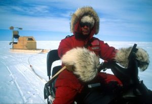
The 2002 expedition was primarily sponsored with private funds, however financial and logistical support was gratefully accepted from the Vancouver Maritime Museum, the Royal Canadian Geographical Society and Scintrex. The field party was comprised mainly of veterans of the Utjulik 2001 survey. The team was again led by Captain Woodman who was accompanied by Ms. Amie Gibbins, Mr. Tom Gross, and Mr. Bill Robinson. Mr. Saul Aksalook of Gjoa Haven, who had also been on the 2001 team as a Ranger participant, was hired as chief guide for the party. The new members of the team were Mr. Kevin Cronin and film-maker John Murray.
The field party spent the period from May 6th to 20th in the Arctic, operating out of Gjoa Haven, Nunavut. In all the survey completed 1628 km of survey line at an average speed of 10 km/hr and covered 151 km2 of area. Analysis of the data collected eliminated five high-probability targets identified in 2001, retained two of those targets for later visual inspection, and located a further six high-priority magnetic anomalies with characteristics consistent with those expected from one of Franklin’s ships. Some traces of prior Caucasian occupation of the islet used for a base camp were also found.
Prior Work and Operational Plan
Franklin’s ships – the EREBUS and TERROR, were robustly built as bomb-ketches and heavily ice-strengthened for Antarctic and Arctic survey work. Traditional stories concerning the circumstances of the sinking of the ship at Utjulik indicated that there was minimum violence done to the vessel and fostered the hope that it would still be relatively intact on the bottom. The vessels were each supplied with large iron steam engines (approximately 15 tons, producing 20-25 horsepower), and were sheathed in iron sheeting around their bows. It was hoped that this amount of metal would make them susceptible to discovery by the local effect on the earth’s magnetic field.
In 1992 an airborne magnetic survey of the Grant Pt. – Kirkwall Is. area had identified 61 magnetic targets – five of which were deemed to be “best priority” with another 20 or so “possibles.” Three of these were investigated in 1993 with a through-ice sidescan sonar, without result. The seaborne surveys conducted in 1997 (magnetometer and sidescan sonar) and 2000 (forward-looking sonar) completed approximately 80 km2 of the entire 300 km2 search area but did not find any traces of the wreck.
Realizing that the entire search area would take a decade to search at the rate allowed by boat expeditions, it was decided to return to magnetometer work to try to identify the location of the wreck. The Utjulik 2001 expedition spent eleven days conducting a sled-borne magnetometer survey over the sea ice in the northern area and was successful in completing the planned search area between Grant Point and Kirkwall Is. at a line spacing of 200m. This survey confirmed the geological nature of most of the previously-identified targets and located a further seven high-priority targets requiring a future higher resolution look.
2002 Irish-Canadian Franklin Search Expedition
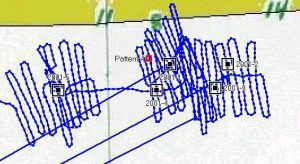
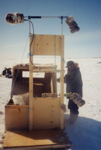
The 2002 expedition was conducted under a Scientific Research Licence issued by the Nunavut Research Institute. An advance 3-person field party assembled in Hay River NWT on 28 April 2002, and flew to Gjoa Haven, Nunavut the next day. Here they were met by their guides, led by Mr. Saul Aksalook, and departed on the two-day trip to Umiartalik Is. (pos. 68.42° N 98.87° W). This group conducted the high-resolution survey of the 2001 targets. Each high-priority target which had been located on the previous year’s 200m grid was enclosed by a box defined by having one snowmobile drive a pattern of lines 1 km long and 50m apart centered on the target. Position was confirmed using handheld GPS receivers operating in non-differential mode (selective availability was off for the period of this survey.) To confirm area coverage trackpoints were recorded to dataloggers from each GPS at 5 second intervals. Track spacing was achieved by a person pacing out the distance and acting as an “aiming point” for the navigating snowmobile. A second snowmobile towing the sled with the gradiometer operator and instrumentation then followed in the tracks established by the navigator.
The high-resolution surveys were run on lines oriented in the generally N-S “troughs” of the sastrugi to minimize pounding of the sleds and equipment. After two days of survey a computerized review of the gradiometer data revealed some abnormalities and it was determined that one or both of the magnetometer sensors had suffered damage from either vibration or freezing (temperatures at the time ranged from –15 to –40 C). This resulted in the need to redo some of the survey on the return trip to Gjoa Haven, which was accomplished on May 18th by the same sub-party of the expedition.
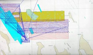
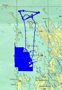
On May 4th the initial party shifted to the south to commence the 200m survey of the area to the northeast of O’Reilly Is. They were joined there by three more members on May 8th which allowed for three survey teams to be established. Weather and equipment permitting survey lines were run in four survey boxes between 8 am and 10 pm daily until May 17th. The following day the parties left camp and departed for Gjoa Haven, one detachment reaching town that day and the other following after a one-day delay at Umiartalik to resurvey some of the missed high-priority targets from 2001. The expedition members departed for Yellowknife on May 20th.
Environmental conditions
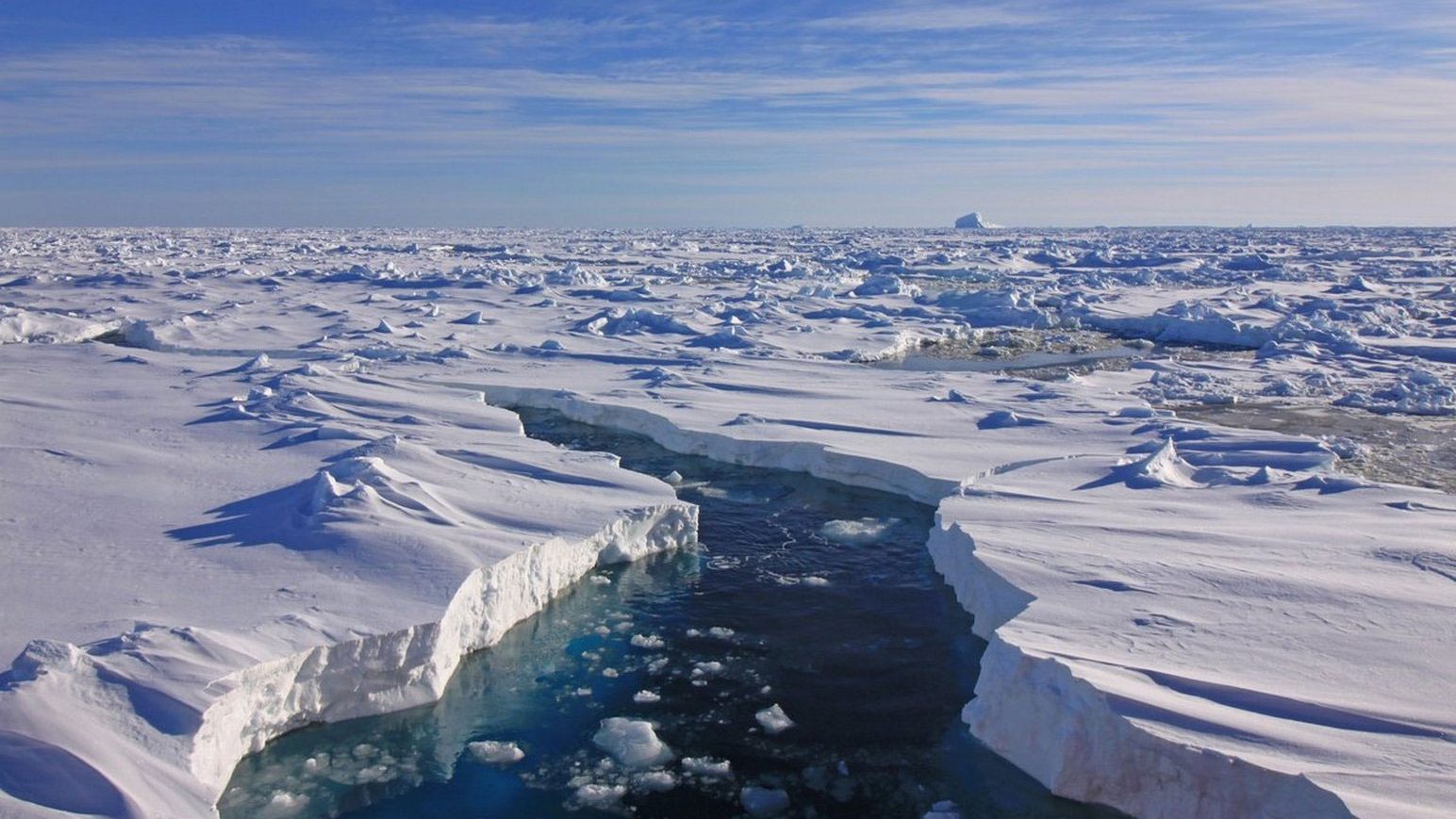
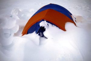
Throughout the fieldwork the weather was generally favourable, although one storm did accompany the shift of camp on May 4th and prevent survey on the following day. Daytime temperatures ranged from –5 to –40C, and the winds ranged from calm to 35 knots, coming from every direction at some time. Whiteout conditions were common, especially in the early morning and evening hours. Approximately 3 feet of snow fell on the camp at one time. Ice conditions were generally good first year ice with 1m sastrugi and some areas of broken ice. The latter appeared to correlate with shallower areas or reefs, and there was a pronounced and lengthy line of such ice running generally along the 99° 03’ meridian in the southern area. It was generally possible to maintain the desired survey lines through and around the broken ice.
Results
During 10 days of survey the expedition completed 1628 km of travelled line spaced at an average distance of 200m and conducted at an average speed of 10 km/hr. It covered 151 km2 of previously-unsurveyed area, essentially matching in the south the coverage which had been obtained in a similar time period in the north in 2001. In addition all seven high-priority targets from 2001 were surveyed at 50m spacing (five twice).
Post-expedition analysis of the magnetic data revealed that five of the 2001 targets were too large and widespread to be from a small wreck (i.e. – they are the result of geological deposits). One of the remaining targets, the best from 2001, remains the best target from the 2002 survey. The other was done once using a malfunctioning gradiometer and will need to be resurveyed. In the southern area six high-priority magnetic anomalies were found exhibiting characteristics consistent with those expected from one of Franklin’s ships.
In the southern area the expedition camped on an un-named islet in Wilmot Bay where a skull, later identified by a forensic specialist as that of a Caucasian male (from photographs) had been found in 1997. We named the islet “Skull Island” and managed to relocate the skull. In addition a thorough surface search of the islet disclosed three large rectangular tent sites identified as definitely non-Inuit by our guides, and a small piece of glass “prism” which may have originated in an optical instrument. Although very tenous these clues were heartening to the crew as potential evidence that we might be near the location of the wreck.
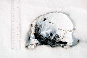
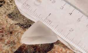
Skull and glass prism discovered on Skull Is. (photo credit Amie Gibbins)
Appendix 1: Irish-Canadian Franklin Search Expedition Team
Mr. Jim Delgado – Archaeologist and VMM Liaison
Dr. George Hobson – RCGS Liaison
Mr. Brad Nelson – Magnetometer data analysis
In-Field party:
Mr. Saul Aksalook
Mr. Kevin Cronin
Ms. Amie Gibbins
Mr. Tom Gross
Mr. John Murray
Mr. Bill Robinson
Capt. Dave Woodman
Guides and assistants: Colin Putuguq, Daryl Kovtek, David Shikshik