Expeditions Overview
The results of my book research were to offer two testable ways to validate the value of Inuit history concerning Franklin. These emerged from the testimony of two eyewitnesses – Puhtoorak and Supunger (each of various spellings).
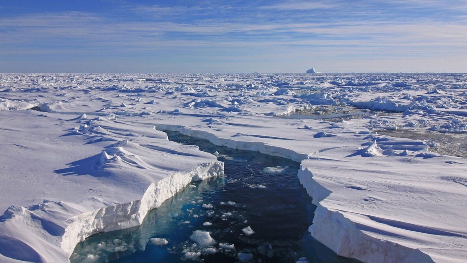
When a young boy Puhtoorak had stood on the deck of one of Franklin’s ships, which had recently been abandoned in perfect order. He described the general location, an area known as Utjulik, to the members of the Schwatka Expedition. Mainly based on his account, supplemented by others, I considered that it might be possible to locate the wreck of this ship and became involved in a multi-year search under “Project Utjulik.”
Supunger had found a site that contained a distinctive grave and associated “vaults” that he believed held buried records. The location was described as lying near the northwest coast of King William Island. His tale became the kernel for “Project Supunger.”
A third project “Project Kia,” was organized to investigate Inuit stories of possible Franklin survivors on the northwest corner of the Melville Peninsula, by relocating a monumental cairn discovered by C.F. Hall there in 1868. Planned for 2008, it was reluctantly abandoned just before departure to the north, when a major funding source failed.
PROJECTS:
PROJECT UTJULIK – 1992-3, 1997, 2000-2, 2003 (cancelled), 2004.
PROJECT SUPUNGER – 1994-5, 1999.
PROJECT KIA – 2008 (cancelled)
***************
Writing about these expeditions falls into four categories:
Thumbnail sketches (this page)
Daily notes taken contemporaneously
Journals expanded accounts written from the daily notes
Formal reports or articles.
Not all expeditions are served by all types of writing. Links to each expedition can be found below.
***************
DETAILS:
1992 – “Project Ootjoolik”
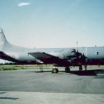
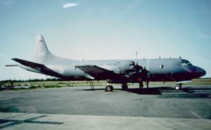
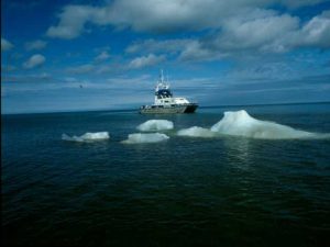
Airborne survey west of Grant Pt with long-range patrol aircraft (Aurora) from the Canadian military. Result: 60+ significant magnetic anomaly “hits,” five of which were deemed possible wrecks—detailed photoreconnaissance of the area that helped update and correct area charts. [link]
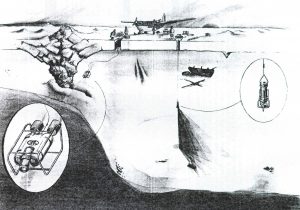
1993: McInnis Franklin expedition. Jointly organized by Dr. Joe MacInnis and myself. A small ski plane was used to land on sea-ice and use “lightbulb” sonar through an augured hole in the ice to investigate the highest priority targets from 1992. Result: Landed briefly at one spot in bad weather and did not get an accurate position. Drilled holes and lowered sonar but discovered “mud, mud, and more mud.” The water depth was approx. 20m which was encouraging.
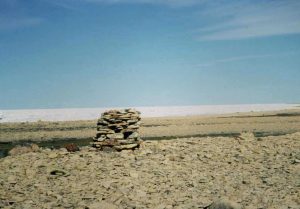
1994: Canadian Geographic Franklin Expedition “Project Supunger.” I organized a team to search for Supunger’s vault between Victory Pt and Collinson Inlet as far east as Cooper Lake. Result: Found some new small traces of metal, cloth etc., at “Crozier’s Landing” and discovered one burial site (later determined to be of Inuit origin). GPS mapped all significant structures (Irving’s grave etc.) No trace of the Supunger site was found. [link]
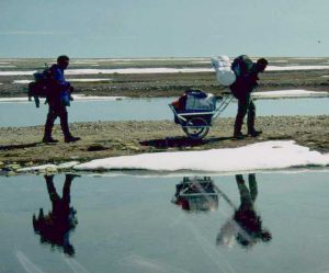
1995: Project Supunger 2. We landed at Cape Felix as one of three parties working loosely together. One group went to rediscover the C. Felix campsite (Bertulli, Gross, Hobson). Another one went to Clarence Islands to locate a reported cairn (under Steve Trafton – did not reach, defeated by sea ice). My group travelled the west coast to Crozier’s Landing in search of the Supunger site. Encountered very difficult conditions. Result: C. Felix campsite was archaeologically mapped for the first time by Bertulli. The rediscovery of a Franklin campsite near C. Maria Louisa. [link]
1997: Eco-Nova Franklin 150 expedition. Served as “search coordinator” for this group, doing both sidescan work from survey boats and shore searches of islands. Most of the time, we searched Grant Pt area. Discovery of some copper items and wood from a small boat resulted in relocation to O’Reilly Island, where little was accomplished because of bad weather. Results: Forty sq km surveyed w. of Grant Point without result. Copper items found in the south, initially thought to be Franklinian, later found to be modern. [link]
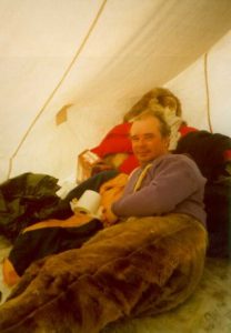
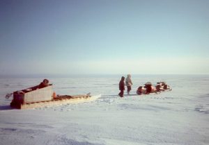
1999: Project Supunger 3. Tom Gross and I snowmobiled to the area around “Hill 222” near Cape Maria Louisa, where Tom believed he had previously seen a site similar to that described by Supunger. We could not relocate it and were hit by a May blizzard that forced us to take shelter in a hunter’s hut at Cape Sidney for five days. Result: A fine adventure, but no result on the Franklin front. [link]
2000: St. Roch II Voyage of Rediscovery. Organized by Jim Delgado, I again served as “search coordinator.” A renewed search of the area west of Grant Pt continuing from the Eco-Nova survey. Nothing found. Shore searches of nearby islands found no Franklin relics. [link]
2001: Project Utjulik. Led team to do sled-borne magnetometer survey. Result: surveyed the remaining northern area (Grant Pt) at 200m spacing for magnetic anomalies. Later analysis revealed seven high-probability hits. [link]
2002: Project Utjulik2 (Irish-Canadian Franklin Expedition). Led team to continue sled-borne magnetometer survey. Result: surveyed northern area (Grant Pt) hits at 50m spacing for magnetic anomalies identified the previous year, then surveyed southern (O’Reilly) area at 200m spacing. Later analysis revealed a total of 14 high-probability hits. [link]
2004: Project Utjulik3 (Irish-Canadian Franklin Expedition2). Led team to investigate highest-probability targets in both areas using a drop sonar through holes in the ice. Result: All targets identified with obvious geological anomalies (outcrops etc.). [link]
Relatively little to show for a lot of effort isn’t it (but it was all, in hindsight, fun)!